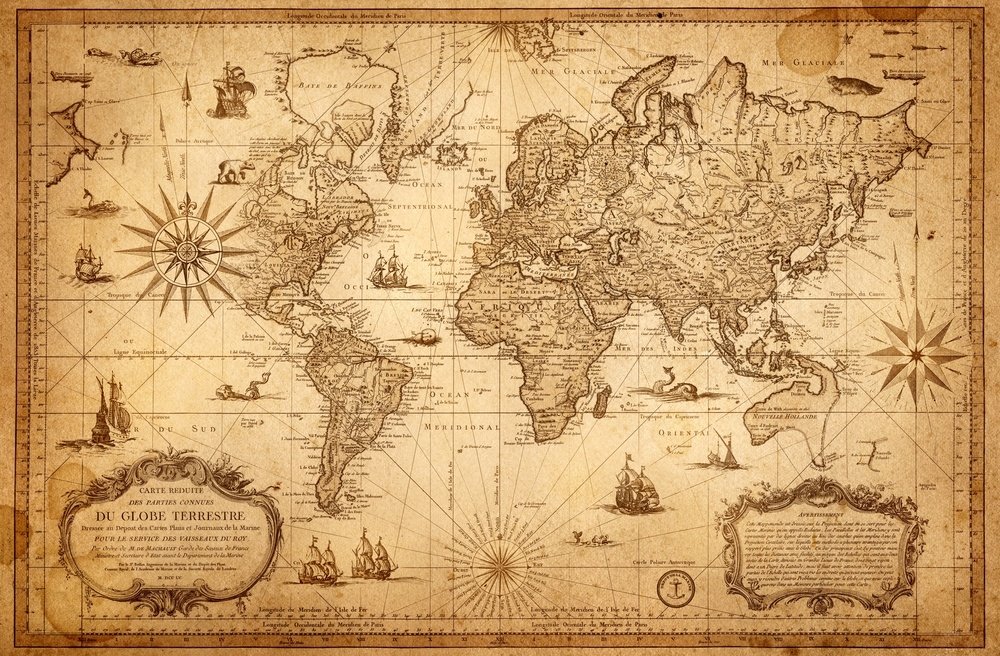
Africa didn't get bigger on Sept. 4. But something important happened that day. The United Nations General Assembly adopted a resolution called “Correct the Map,” led by Togo and the African Union, calling for more accurate representation of the relative size of the world's regions on maps.
The resolution passed by 164 votes to one, with six abstentions. It does not ban the Mercator projection, change any borders or impose a single replacement map. Instead, it encourages governments, schools, international organizations and technology companies to consider equal-area projections, such as Equal Earth, when the relative size of landmasses matters.
The issue may sound technical. It is not entirely so.
For decades, the Mercator projection has been one of the most familiar ways to view the world. Designed in the 16th century primarily for navigation, it preserves directions well but significantly distorts the relative size of landmasses, especially toward the poles. Africa, close to the equator, appears much smaller than it actually is. So, did the U.N. make Africa bigger?
No. Africa was already big. The more interesting question is why the way we draw the world has become important enough to generate an international debate.
Because a map is never a neutral canvas. It is an architecture of consciousness. Even when nothing changes on the ground, a map can profoundly change the way we perceive, understand and interpret that ground.
To address the issue properly, we must first dismantle a common misconception. Africa has not been expanded; its physical mass remains precisely what it has been for millennia. What is shifting is the lens through which human eyes observe its relative proportion.
The Mercator projection, formulated in 1569, wasn’t born out of a secret geopolitical conspiracy to shrink Global South continents. It was an ingenious piece of mathematical engineering designed for mariners navigating treacherous seas. By preserving straight lines of constant compass bearing, it let sailors cross vast oceans without losing direction.
However, mathematical utility often produces spatial distortion. To flatten a sphere onto a rectangular sheet, Mercator stretched the polar regions while compressing the equator. In this mathematical compromise, territories far from the equator expanded dramatically, while equatorial regions shrank into relative modesty. Greenland was able to match the size of the entire African continent, even though Africa is, in truth, more than 14 times larger.
The problem arose when a navigational instrument became humanity’s cognitive atlas.
When a tool designed for ships becomes the blueprint for classrooms, it ceases to be a mathematical convenience and becomes a subtle teacher of distortion, through which Africa appears modest and peripheral in classrooms around the world.
It is easy to craft a melodramatic narrative around this: to claim that imperial powers sat in dimly lit rooms plotting to shrink Africa on paper to cultivate an enduring complex of inferiority. History, however, is rarely governed by caricatural villainy; it is governed by habit, convenience and institutional inertia. Yet falling into the opposite trap, like dismissing symbolic representations as meaningless because they do not alter physical matter, is equally naive.
Humanity does not inhabit a purely physical landscape. We live in the psychological ecosystems we construct around that landscape.
For centuries, the international imagery surrounding Africa has suffered from a restrictive, monochromatic palette. It has been a canvas dominated by recurring motifs: crisis, famine, civil strife, disease and the inevitable arrival of external humanitarian aid. Even when these images capture authentic moments of tragedy, their endless repetition transforms episodic events into an ontological definition. The continent was gradually reduced from a vibrant, complex political space into a perpetual patient awaiting diagnosis.
In this environment, spatial visual distortion becomes a subtle catalyst. When a landmass is visually shrunken for centuries, its concerns can be treated as structurally secondary. A distorted map creates a distorted sense of proportion, influencing geopolitical empathy and economic investment. Yet changing the projection will not decolonize Africa, reform monetary policy, eliminate youth unemployment or halt regional conflicts. Therefore, expecting a cartographic adjustment to perform the heavy lifting of governance and structural reform is a dangerous illusion. If we ask a piece of paper to cure institutional ailments, we doom ourselves to bitter disappointment. But that does not mean it is useless. Because representations are not without consequences.
This explains why nations such as Canada and Russia, whose landmasses swell to majestic proportions on Mercator maps, supported the U.N. initiative. The effort was not conceived as a zero-sum game of spatial humiliation. Nobody asked Russia to forfeit territory, nor did Canada expect to surrender its frozen expanses. It was simply a long-overdue calibration of our shared compass.
Why has this cartographic debate resonated so deeply across the African continent and its diaspora?
Because Africans have long endured the burden of viewing themselves through external mirrors. They have lived within narratives authored by distant observers, where their history was framed as a footnote and their geography as a quiet background. The enthusiasm surrounding accurate spatial representation is not an obsession with scale; it is an appetite for truth.
This raises a question at the heart of cultural sovereignty: Who holds the brush that paints the world inside our minds? If external projections define our spatial, historical and economic centralities, we remain passengers in someone else’s geographical imagination.
What is changing is our collective resolve to look at the world without the distorting lenses of past-century habits.
Before we demand that the international community reshape its economic and political posture toward Africa, we must first ensure that the map hanging in our minds is drawn to scale. Africa’s problem has never been one of size, but of representation. While this may not immediately change the continent’s reality, it can at least remind us of one essential thing: a map cannot build a bridge, but it can dictate where we imagine bridges ought to be built. It cannot feed a city, but it frames how we perceive the vast agricultural potential of an uncompressed continent.
Symbols are not mere decorations on the surface of reality; they are the anchors that reach deep into the ocean of human perception. Africa has not become larger. It remains what it has always been: the second-largest continent on Earth, a vast, diverse and teeming landmass that bridges hemispheres, cultures and futures.