The General Directorate of Mapping (HGM) under the Ministry of National Defense and the Navigation, Hydrography and Oceanography Department of the Turkish Naval Forces participated in the 9th National Antarctic Science Expedition, conducting measurements on land and sea.
The 9th National Antarctic Science Expedition, organized under the auspices of the Presidency, led by the Ministry of Industry and Technology, and coordinated by the Scientific and Technological Research Council of Türkiye Marmara Research Center (TÜBITAK MAM) Polar Research Institute, continues.
As part of the expedition, the General Directorate of Mapping, continuing its cartographic studies in the footsteps of Piri Reis, established new survey stations and monitored the region’s tectonic movements using terrestrial geodetic data.
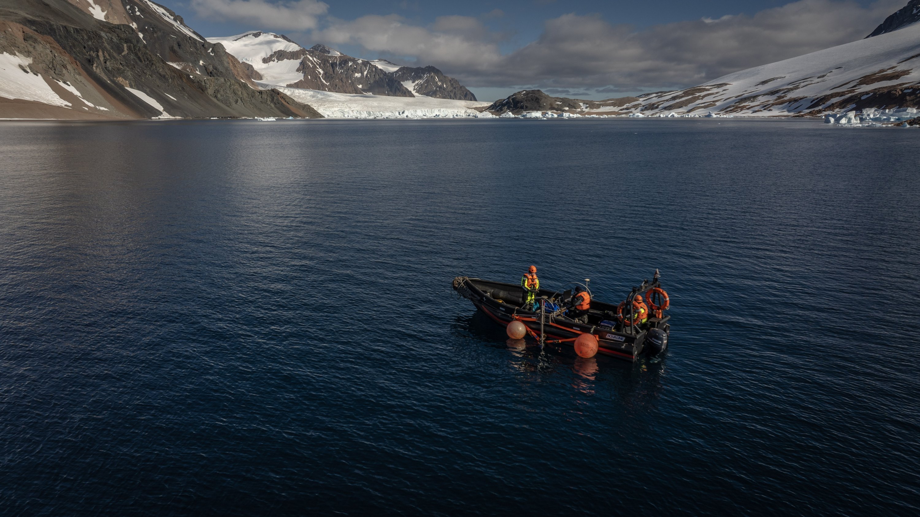
For the first time this year, bathymetric studies critical for maritime navigation were conducted in Gaul Bay near Horseshoe Island. The Navigation, Hydrography and Oceanography Department of the Turkish Naval Forces Command created new bathymetric maps of Gaul Bay, gathering significant data on the region’s underwater structure.
Professor Hasan Hakan Yavaşoğlu, leader of the 9th National Antarctic Science Expedition, told Anadolu Agency (AA) that they carried out various studies across Horseshoe Island.
Yavaşoğlu highlighted the significance of the bathymetric maps produced by the Navigation, Hydrography and Oceanography Department for ship navigation, logistics and passenger transfers. This year, for the first time, ship passages and hydrographic measurements were conducted in the northern and northeastern regions of the island, including Gaul Bay.
Discrepancies were found in older maps, and the collected data will help resolve these differences, making navigation safer and easier. He explained the excitement of collecting preliminary profile data and successfully entering Gaul Bay, which had never been surveyed before.
Another key study was the establishment of geodynamic stations around the island, including one on a small island between Dismal and Horseshoe Island. This data will aid in analyzing fault lines, volcanic effects and seismic risks.
Abdullah Kellevezir, a terrestrial application officer from HGM, discussed their work in Antarctica, where they’ve been conducting GNSS and GPS measurements since 2020. This year, a new geodetic point was established to monitor tectonic movements and deformations on Horseshoe Island.
Master Sergeant Ömer Faruk Topkaya shared his role in collecting high-resolution bathymetric data around Horseshoe Island, contributing to updated navigation maps for safe travel and scientific research in Antarctica. He emphasized the use of satellite antennas and Multi-Beam Echo Sounder systems for depth mapping and the integration of oceanographic measurements to improve accuracy.
Topkaya also reflected on the historical significance of the Piri Reis map, drawing a parallel between their work and the 1513 map, which depicted the South American coastline, the nearest landmass to Antarctica. Topkaya noted their pride in producing a new navigation map for Antarctica, ensuring the safety of Türkiye’s maritime operations and research.