GENERAL STAFF DISCREDITS WALL STREET JOURNAL
Turkey's Chief of General Staff has released details of the flight route followed by the Turkish F-4 jet through maps on their internet website, which discredits the Wall Street Journal's allegations the fighter jet was brought down over Syrian territorial waters.
The following are a number of items mentioned in the description of what transpired during the Turkish reconnaissance flight:
ONE MILE OUT OF SYRIAN TERRITORIAL WATERS
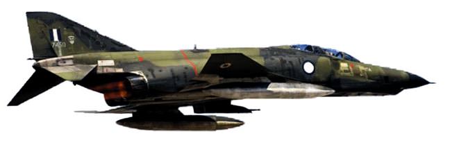
On June 22nd, 2012 a single aircraft (and not two as alleged) belonging to our Air Forces, was on a reconnaissance flight in the Eastern Mediterranean, unarmed with all recognition systems intact, in order to test the performance of our current radar system, when it was brought down.
After inspecting radar imagery, it has been established that the jet took off from Malatya/Erhaç at 10:30 to conduct its first test flight and reached the number one profile spot at 11:06, where it began flying at 21,400 feet elevation. At 11:14, the plane reached its second profile stop at 8,600 feet elevation and at 11:23, the jet was at the third profile stop at 7,500 feet elevation. At 11:37, the F-4 reached the fourth number profile stops at 2,000 feet elevation and at 11:50, the plane was at 3,000 feet elevation and at the turning point for the second test flight. In the final profile, our plane committed a five minute border violation. According to radar analysis and wireless communication, during this time, there was no intervention made during the flight. While on its second test flight and headed towards the fourth number profile at 7,400 feet elevation, at 11:56 the jet immediately dropped in elevation while in international airspace and at 11:57, all radar communication and contact was lost.
According to radar visuals and the results of an administrative investigation, our plane was shot down one mile outside of Syria's 12 mile-wide territorial water, which means it was shot from a 13 mile distance. The coordinates obtained from the jet's final destination while still flying stable were 35 48.22 North, 35 33.21 East. When the plane began to lose elevation and speed it was 8.5 miles away from Syria and most likely crashed at the following coordinates: 35 48.26 North, 35 37.59 East.
The location of our pilots is still unknown. The explorer ship Nautilus will be in the region by this evening to assist in the search efforts.
SUNDAY TIMES: RUSSIA BROUGHT DOWN THE PLANE
An article released in England's Sunday Times entitled "Russia's finger on button that destroyed Turkish jet," alleges that Russia may have been involved in Syria's shooting down of a Turkish fighter jet.
Quoting Middle Eastern sources, the decision to down the Turkish jet was intended to signal a warning to NATO to stay out of the conflict raging in Syria.
Israeli newspaper Haaretz also commented on the allegations purported by the Sunday Times by writing that three years ago, Russia supplied Syria with advanced anti-aircraft missile systems. Haaretz also stated that it is believed that Russian specialists trained Syrian forces to use the systems. Haaretz went on to state that according to diplomats that spoke with the Sunday Times, some Russian specialists are still stationed at the missile battery control centers. A source from the Israeli air force told the British paper, "We would not be surprised if these Russian experts, if they didn't push the button, at least were beside the Syrian officers who did it."